Tag Archives: Walkability

Living the High-Line Life

Converting an eyesore into a celebrated park, New York City’s High Line showed how smart urbanism can create wealth.

by James A. Bacon

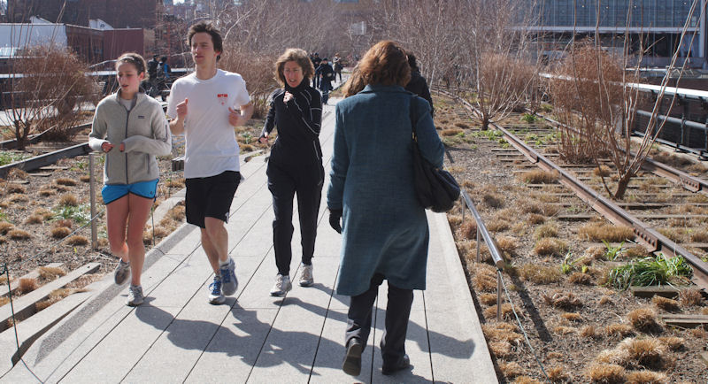
It was cold and blustery in New York City last week but the weather did not dissuade thousands of Gothamites and tourists from taking a walk along the High Line. The park, which snakes between, under and through apartments and office buildings on an old, elevated railroad bed, is popular year-round.

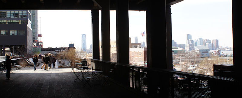
In mid-March the summer-lush gardens were dormant, with only a few blossoms budding. Still, the long, winding trail provided incredible views of Manhattan and the Hudson River. Every twist in the path offered new visual treats.

The seats and chairs were mostly empty — it was far too cold for sitting — but hundreds of people were jogging, strolling, gawking and even walking their dogs.


The freight line was built in the 1930s, thirty feet off the ground to remove dangerous trains from the streets of what then was New York’s largest industrial district. By the 1990s, the manufacturing operations along Manhattan’s west side had disappeared, the trains had stopped running, and the freight line was regarded as an eyesore. As New Yorkers debated what to do with the line — demolish it, convert it to mass transit — a remarkable thing happened: Nature took over. A disorderly profusion of plants colonized the track. Then the idea took root to preserve the rail line as a two-mile ribbon of green.

Today, New York City owns the High Line and the non-profit Friends of the High Line maintain it. The park is widely regarded as one of the most successful examples of urban reclamation in the United States and has served as an inspiration to civic enthusiasts around the country.

In my home town of Richmond, for instance, there is a concerted effort to build an elevated “urban oasis” over the James River. Although I’m a bit squeamish about the price tag, I think the BridgePark is one of those big ideas that can make an iconic statement and transform the city’s image. Also, I’m increasingly convinced that one of the few viable strategies for regions and communities to dig themselves out of the fiscal sink-hole they find themselves in is to pay more attention to “place making,” which creates economic value rather than destroying it as so much of our post-World War II development has done. The High Line shows how making places where people love to spend time can create economic value.

The urban fabric along the High Line is undergoing a transformation. There are several major construction projects underway along the route, and even buildings that aren’t undergoing major renovations are adapting themselves to the park’s existence. I don’t know the stories behind these initiatives but I can point to them as examples of the positive dynamic that the park has engendered.

As seen in the photo above, someone applied a rough-textured material to the glass windows of an adjacent building to create an arresting visual effect. I suppose you might call it art. Whatever term you use, the material injects an element of the unpredictable. So did the odd piece of metal-and-wool craftsmanship to the right. The object (I don’t know what else to call it) is not exactly art for the ages, but it is whimsical and fun. I expect that we’ll see a lot more creations like these, as artists and philanthropists donate more pieces.

The Friends of the High Line organization also puts on guided tours, star-gazing sessions, dance parties, art events and food festivals during warmer months, creating a magnet for activity that draws people from far and wide. Where people like to congregate, they also like to live. Where people like to live, property values rise — and so do tax revenues.

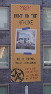
In a sure sign that the High Line is creating economic value, property owners have begun touting proximity to the park as a selling point for renters. “Home on the High Line!” proclaims the banner to the right, displayed to joggers and pedestrians on the elevated path. Property owners also are promoting a High Line location for business offices. “High Line Your Business,” exhorts signage overlooking the urban trail, morphing the name of the park into a verb.

Academic studies have shown that parks increase the value of nearby property by 10% or more. Obviously, some parks have a greater positive impact than others. Those that become dead zones, inviting only vagrants and petty criminals, can hurt property values. But parks like the High Line that are capable of luring visitors even on cold, windy days, enhance property values and create wealth. Read more.

Fixing Broken Streams and Broken Dreams

The Bellemeade Walkable Watershed project aims to reclaim a damaged creek, create a route for kids to walk to school, and boost community spirit in a gritty, inner-city Richmond neighborhood.

by James A. Bacon

Bob Argabright got involved with Richmond city schools nine years ago when he volunteered to help two young students learn to read. It wasn’t long before he discovered that the challenges faced by inner city kids run far deeper than a difficulty with letters and words. As he delved deeper into their lives and their surroundings, his volunteer activity became a full-time vocation. Today, the retired paper industry executive is such a fixture at Oak Grove-Bellemeade Elementary School that children wave to him in the hall, call him by name and even run up to give him a hug.

“I think it’s totally unfair for a child to be born in the 23229 zip code and be set for life while a child born in 23224 has a low probability of success,” says Argabright. “Ninety percent of our kids say they want to be a rap star, an NFL football player or a beautician. We’re trying to show them other paths. … We’re teaching these children to dream.”

As unlikely as it might sound, Argabright is hoping that a few children might conceive the ambition of becoming an architect or an environmental engineer.

Making that connection would have been unlikely a year ago, when the students at Oak Grove-Bellemeade were attending the old Bellemeade Elementary School, an aged and decrepit school building that screamed urban blight. But this month they moved into a new, LEED-standard school building next door that is fresh, clean and airy. Every section of the school bears a name associated with the James River — the river bed, forest floor, forest canopy, and the like — to serve as inspiration for teaching about nature. Moreover, the city is moving forward with a project to restore the severely eroded creek behind the school with the aim of creating a community resource and a focus for environmental education.

The Bellemeade Walkable Watershed is a triumph of public-private collaboration, says Michelle Virts, deputy director of utilities. “It’s a great opportunity for the city to stretch our dollars.” The project is funded largely through a $187,000 National Fish & Wildlife grant to restore the creek, and a $60,000 Environmental Protection Agency grant to build a watershed coalition, but the city is chipping in land, public works money and staff time, while not-for-profits like the James River Association and the Alliance for the Chesapeake Bay are providing volunteers for clean-up and money for tree planting.

Perhaps the most intriguing aspect of the walkable watershed is how the community is leveraging a single project to advance multiple goals: stream restoration, environmental education, a community garden and a network of sidewalks and trails. By making it possible for hundreds of kids, many of whom live in housing projects, to walk or bicycle to school instead of ride the bus, the project, it is hoped, will ward off the obesity that plagues Richmond’s inner city.

Many educators, public officials and not-for-profits have contributed to the project. But Argabright is the thread tying the efforts together. “Bob is extremely active in the neighborhood,” says Virts. “He makes things happen.”

“Bob Argabright is totally on fire about this thing,” says Champe Burnley, president of the Virginia Bicycling Federation, who recalls meeting with him more than half a year ago. Argabright was thinking ahead to when the new route opens for children to walk and bike to school. How many poor kids own bicycles? Not many. Even back then, he was working the angles to rustle up some used bikes. He now has 300 (only some of which, he regrets, are suitable for children) sitting in a warehouse in anticipation of the day when they can be used.

Argabright is not one to claim credit. He sings the praises of everyone involved in the project, from Oak Grove-Bellemeade’s principle Jannie Laursen to Lara Kling with the Blue Sky Fund, which has raised $275,000 to fund outdoor nature programs for inner city schools, including Oak Grove-Bellemeade. He depicts his contribution mainly as showing up at community events, pushing to get things done and building a web of contacts linking corporate leaders with City Hall and neighborhood volunteers and activists. Says he: “What I’m doing is networking, doing what I’ve done my whole career.”

Re-greening Richmond

Two developments were key to making the project happen. One was construction of the Oak Grove-Bellemeade School, which opened its doors this year. Children from the old Bellemeade School, located right next door, moved in right away. Students from Oak Grove will transfer next school year. The 90,000-square-foot facility is state-of-the-art. But it’s one thing to teach a subject like science in the abstract to inner-school children who have seldom ventured outside their concrete-and-asphalt domain, and quite another to teach them in a natural environment. More.

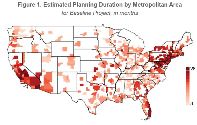
Chart of the Day: Planning Regulation

Graphic credit: UCLA

Stephen Oliner, a UCLA professor doing research for the Federal Reserve Board, has made the first-ever estimate of planning times for commercial construction across the United States. Drawing upon 82,000 projects nationwide, he found that the average planning time nationally is about 17 months. But it’s a long longer in some places and shorter in others.

Based on Oliner’s map, it appears that Virginia has a lot more in common with the blue states in California and the Northeast than “red” flyover country when it comes to planning regulation. Indeed, the state looks like an extension of the Washington-New York-Boston megalopolis. (Hat tip: Timothy Wise.)

Bacon’s bottom line: What does this mean for development and re-development in Virginia? If, as I believe, population growth and real estate investment is gravitating back toward the urban core, longer planning times slow the market’s adaptation to changing consumer preferences and economic conditions. As documented in “The Great Inversion and the Future of the American City,” in Houston, which has no zoning and minimal red tape, developers can turn on a dime in response to changing market conditions. The zoning restrictions and other red tape we have in Virginia (a) makes real estate more expensive, and (b) slows the evolution of human settlement patterns in response to market demand toward more compact, walkable communities. Not good.

— JAB

Suburban Redevelopment in Merrifield Wins NYTimes Nod

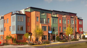
EYA Townhomes in the Mosaic district

Taking notice of redevelopment in the Merrifield area of Fairfax County, The New York Times has suggested that this “suburban wasteland in Virginia” is at last getting an urban feel.

The centerpiece of the suburban makeover is the 31-acre Mosaic district, a project of Columbia, S.C.-based Edens, a private retail developer. When fully built out, the mixed-use project will include 500,000 square feet of retail and 1,000 residential units. Writes Alison M. Rice for the NYTimes:

In the Mosaic District, Edens grouped its tenants by type, clustering specialty grocers such as MOM’s Organic Market close to a butcher, fish market and wine shop, for example. “Mixed use has relied on food of all kinds as its primary anchor, from Whole Foods to Harris Teeter and restaurants of all types,” said Maureen McAvey, a retail specialist with the Urban Land Institute in Washington. “As bookstores closed, food has become even more important” to retail development.

Trendy new retail concepts are great, but they may not prove enduring. What Merrifield still really needs is the sought-after “walkability” factor, and that, in Rice’s appraisal, remains elusive. “Intended as a pedestrian-friendly town center and less than a mile from a Metro station,” she writes, “Mosaic is still best reached for many visitors by car or bus, rather than on foot, because of traffic on nearby roads.”

Six decades of disastrous land use decisions will not be reversed by a single project. The vast quilt that is Fairfax County, home to more than one million residents, can be repaired only one patch at a time. Fortunately, developers like Eden are quick to respond to changing market preferences and local government leadership seems willing to let the county evolve.

JAB

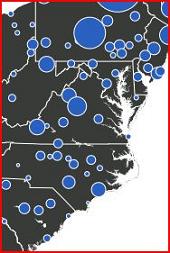
IG of the Day: Walking Communities

Governing magazine has just published an interactive map showing which United States metros have the highest percentage of workers who walk to work. No surprise, the leaders in Virginia are small metros with large student populations — Charlottesville, Blacksburg and Harrisonburg.

The graphics are somewhat deceptive, however. The size of the dot appears to bear some correlation to the percentage of population that walks to work, but it’s an imperfect one. (Hampton Road’s dot is so small it barely registers on the map, yet the percentage of population walking to work is nearly double that of Richmond.) So, to make sure you get an accurate picture, here’s the key data extracted from the interactive features of the map:

6.1% — Charlottesville
5.1% — Blacksburg/Christiansburg
4.7% — Harrisonburg
3.2% — Washington
3.2% — Lynchburg
2.7% — Winchester
2.5% — Virginia Beach/Norfolk
1.8% — Roanoke
1.4% — Richmond
1.1% — Danville
1.0% — Bristol/Kingsport

— JAB

Talking the Talk, Walking the WalkUp

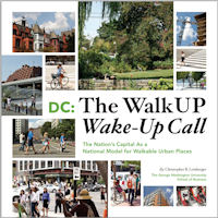
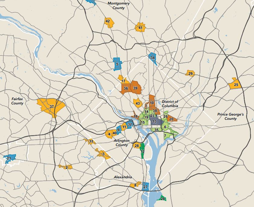
Momentum is shifting decisively from the traditional model of auto-centric development associated with “suburban sprawl” to WalkUps, the term that urbanist Christopher B. Leinberger has coined for Walkable Urban Places. Not only that, contends Leinberger in a new paper, “D.C.: The WalkUP Wake-Up Call,” but the Washington region stands at the vanguard of the national trend.

That may come as a surprise to those who know the region primarily for its hellish traffic congestion and developers’ voracious appetite for land. Despite its fearsome reputation for traffic gridlock, metropolitan Washington stands near the top of national surveys of walkability and the region has emerged since the 1990s as an example of how the nation should develop the built environment, Leinberger contends.

In the 1992-2000 business cycle, the share of office, retail, apartment and hotel property built in WalkUP neighborhoods was 24%. Between 2009 and the present, market share stood at 48%. In the future, predicts the George Washington University professor, WalkUps will continue to predominate as the market corrects for changing demographics and the excess supply of car-centered communities erected in previous building booms.

Leinberger defines six types of regionally significant WalkUPs: downtown, downtown adjacent, urban commercial, surburban town center, strip commercial redevelopment and greenfield. The Washington region is unique in the country for having all six types. He has identified 43 of these places, with the main concentration in the urban core of the District of Columbia but with a remarkable number (remarkable to me, at least) in Northern Virginia.


The 43 WalkUps are roughly 15 times more densely developed than the rest of the region. While accounting for less than one percent of the land mass, they account for one-third of the region’s employment. WalkUPs hold an even higher percentage of primary jobs (as opposed to local service jobs). These places are light on residential, contributing only three percent of the regional inventory. But the sales value per square foot for residential is 71% higher than for other areas. Likewise, office rent per square foot runs about 76% higher.

Leinberger ranks WalkUPs as copper, silver, gold and platinum, depending upon various walkability criteria including the presence of mass transit. Copper WalkUPs are walkable communities in the making where local governments have made necessary zoning changes and invested some of the required infrastructure but the private sector is only beginning to respond. Tysons Corner is an example of this type. Despite limited change, office leases go for a 4% premium, while housing price sales are 13% higher.

The Silver WalkUps in the Leinberger classification are 53% more dense than the Coppers and have 44% higher rents. The Golds have 19% higher rents than the Silvers, while the Platinums — downtown Washington, Georgetown — have 19% higher rents than the Golds.

Leinberger posits a strong connection between the average education level of a region’s workforce and its preference for walkable communities. Knowledge workers are driving the trend to walkable urban places. As the metropolitan region with the highest level of education in the country, he writes, Washington is “farthest along in adjusting to the demands of the knowledge economy.”

A rise in highly educated knowledge workers has powered the explosion in demand for and development of walkable urban places in metro D.C. and elsewhere. These highly educated creative class workers, especially the young Millennials (born between 1982 and 2004), want the option of living and working in walkable urban places. Since metro D.C. has relatively more of these workers than any other metropolitan area, it is not surprising that it leads the WalkUPs phenomenon. As these Millennials age,  many seem to be moving to or near suburban WalkUPs, such as Arlington. When it comes to developing suburban WalkUPs, metro D.C. has a substantial lead  over all other U.S. areas.

Bacon’s bottom line: I agree with Leinberger’s broad thesis, although I do think he pushes it too far at times. For instance, he entertains the possibility that walkable areas have greater social equity than other parts of town, thus creating a liberal-progressive trifecta of economic efficacy, environmental sustainability and social justice. The case is less than persuasive, as he reluctantly admits. The fact that walkable, mixed use areas command the highest premium for rents, house sales and office leases guarantees that only the most affluent members of society can afford to live and work there.

However, inequities could diminish if more WalkUps development occurs. The premium price for rents and leases stems from the relative scarcity of these places compared to the demand for them. Build enough and the premium will disappear.

In the meantime, all Virginians (including Northern Virginians) will have to look at metropolitan Washington very differently. Far from representing what’s worst and most dysfunctional about human settlement patterns, the region could be some 40 years ahead of other regions in adapting land use to the exigencies of the Knowledge Economy.

— JAB

Eating the World’s Most Delicious Philly Cheesesteak at the Reading Terminal Market


by James A. Bacon

When the Bacon family visited Philadelphia this weekend to watch the Eagles play the Baltimore Ravens, there was only one thing I wanted out of the trip. I had to chow down on an authentic Philadelphia cheesesteak sandwich. I’d tasted ersatz cheesesteak hoagies in Virginia but that was like ordering grits… in Connecticut. Or hamburgers… in Spain. (Trust me, I’ve tried the latter, and it doesn’t work.) I craved the real thing.

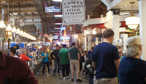
As it turns out, you can’t walk 20 feet in downtown Philly without bumping into a restaurant or food cart that sells the sandwiches. But I had the good fortune to purchase mine from Carmen’s Famous Italian Hoagies and Cheesesteaks. Not only is Carmen’s arguably the Maxim’s of the junk food world, it was located in the Reading Terminal Market, which is surely one of the busiest indoor food courts in the western hemisphere. Originating as a farmer’s market, the Market has evolved into something more: a popular tourist destination and fun place for native Philadelphians to hang out.

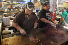
Making cheesesteaks is an assembly-line process at Carmen's. When all you do eight hours a day is prepare hoagies and cheesesteaks, like these two guys, you get reaalllly good at it.

My half hour wait in line was worth the delayed gratification. Loaded with peppers, onions, mushrooms and Cheese Whiz — yes, Cheese Whiz is an indispensable ingredient, or so I was informed — my sandwich fully lived up to expectations. The popularity of Carmen’s and cheesesteaks generally also helped  explain why Philadelphia has the highest obesity rate of America’s largest cities.

The Philly Cheesesteak is a relic of the city’s glorious industrial past. These days, the knowledge-intensive Philadelphia region, with all of its universities and law schools, is being overrun with foodies and health nuts. Sunday morning, a half-marathon outside our downtown hotel attracted thousands of runners. The two sit-down restaurants where we ate served only organic food. And there is a major government-civic effort afoot to attack the city’s “food deserts” by inducing its ubiquitous corner markets to stock fresh fruit and vegetables.

My takeaway from Philadelphia for Virginia is this: Farmers markets are sprouting everywhere. That’s understandable: People love food and they love watching other people. Grocery shopping becomes a social event. It may be tempting to fashion a particular “vision” for these markets. Don’t. Let them evolve naturally in line with the character of the regions and neighborhoods they serve. In the Reading Terminal Market, Carmen’s coexists with Wan’s Seafood and an Amish dairy. There are sellers of herbs, purveyors of chocolates, cutters of flowers and vendors of free-range poultry. The result is culinary chaos — and a lot of fun.

The beauty of the Reading Terminal Market is that it has a roof and four walls, which provides a sense of permanence and encourages merchants to invest in counters, lighting, signage and displays that draw more patrons. Its location in a highly walkable, mixed-use downtown district also encourages loads of foot traffic. (Much of the traffic at Carmen’s was carry-out.) There are no national food chains there — all businesses are local and contribute to the regional economy. That’s a great business model for enterprising Virginia developers to emulate.

The Densification of Richmond

Pressure is intensifying to redevelop Richmond’s retail enclaves at greater densities. But locals love the Libbie & Grove shopping district just the way it is. Is there a way to accommodate both?

by James A. Bacon

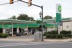
The Libbie & Grove shopping district is little known outside the west end of Richmond but it is much beloved by the people who live nearby. There is nothing especially distinctive about the architecture of the shops and restaurants – indeed the styles are very much mix and match. Some of the buildings, like a 7 Eleven and BP gas station, are major eyesores. But the retail district has an indefinable aura that makes it a great place.

The Westhampton Theater, the only movie theater in Richmond that plays independent and foreign flicks, is a major draw for the city’s wine and brie crowd. Phil’s Continental Lounge, a neighborhood restaurant and bar from another era, draws more of a beer and bubba clientele. Peter-Blair displays what just be might the world’s gaudiest assortment of bright, preppy neckties. There are numerous eateries in the area, and they all provide sidewalk dining. It’s fun to walk around, windowshop and bump into people you know.

For a fleeting moment, one might say, the Libbie and Grove area has achieved a state of urban grace. Everybody loves it, and no one wants it to change. But, as former Beatle George Harrison once crooned, all things must pass.

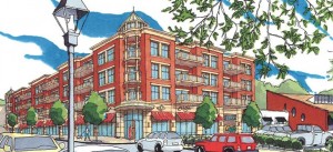
Artist's rendering of the Highline Developments project at the corner of Libbie & Grove

The mixed-use building would replace a BP gas station.

Highline Developments BP LLC has asked the city for a special use permit to build a four-story apartment and retail center where a BP gas station now stands. The project would offer several amenities, not the least of which is replacing the ugly gas station. Plans call for 24 parking spaces behind the building with another 53 underground, expanding the supply of desperately needed parking in the area. The ground floor would be devoted to shops and restaurants, while 22 apartments would reside in the upper floors. Perhaps most notably, the building would be architecturally striking. A cupola would provide a visual focal point the district now lacks.

There would be another big bonus for the city. The mixed-use building would generate roughly $150,000 in property tax revenue in place of a gas station that contributes only $11,000 in property taxes now. If the City of Richmond to wants to rebuild its tax base, it will have to encourage the higher-intensity development along its commercial corridors.

But the project has a major drawback – it’s big. The four-story structure will dwarf nearby buildings. The roof height would be 53 feet; the cupola would soar to 68 feet. That compares to 35 feet for the Westhampton Theater, the tallest existing building. By setting a precedent for developers to propose more tall, mixed-use buildings, it will forever change the character of the retail district.

The Richmond region is at a crossroads. The tide of development is shifting from the metropolitan periphery back toward the urban core. The new dynamic is most visible downtown, in Shockoe Bottom, the Canal district and the old Manchester neighborhood across the river. While a handful of downtown projects generated controversy because they would block the river views of established homeowners, redevelopment has been relatively free of conflict with adjacent neighborhoods. But not everyone who wants to move back into the city wants to live downtown. Developers are betting that there is pent-up demand for luxury condomium living in an affluent neighborhood like Libbie & Grove.

Pressure to re-develop traditional Richmond neighborhoods at greater density will only intensify. The question is, can the city accommodate the redevelopment, which is far more efficient from an infrastructure-utilization point of view than building in a green field on the metropolitan edge, or will resistance from neighbors limit the city’s evolution? Given the city’s status-quo vision for the city’s west end and outspoken community opposition, the answer is not at all clear.

You won’t find any grand mansions near Libbie & Grove, unless you cross River Road to the estates near the James River or travel a ways down Three Chopt Road. The houses are understated in the old Virginia manner but well-to-do. St. Catherine’s School, with its manicured grounds and stone school buildings, is within a short walking distance of the shops, while the Country Club of Virginia lies just beyond. St. Stephen’s, one of Virginia’s largest and wealthiest Episcopal churches, is only a block or two away, and the University of Richmond, St. Christopher’s School and Saint Mary’s Hospital are just down the road.

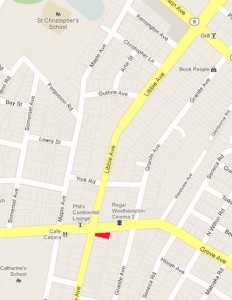
The red patch shows the location of the proposed mixed-use building. (Click for a more legible image.)

Though known as “Libbie & Grove,” the retail district technically follows Libbie all the way down to Patterson Ave. and encompasses several blocks of commercial activity there as well. The city’s Master Plan supports the status quo for the area, noting, “Opportunities for redevelopment or change in use … are extremely limited.” The plan’s guiding principles state that, in general, residential areas should be protected from commercial encroachment and that, in the specific case of Libbie/Grove, “the vitality of the commercial service centers … should be maintained by placing limitations on the extent and character of expansion to those areas.”

In 2010 the city embarked upon a review of the Master Plan for Libbie & Grove at the request of the area’s City Council representative Bruce Tyler. After a series of public hearings, stakeholders reaffirmed the Master Plan’s land use recommendations for the district. However, Scott Boyers, a CB Richard Ellis broker and investor in the Highline Developments project, says the review was a two-step process. The first phase, which is complete, created a “framework” for the area. A follow-up phase, which has not yet occurred, would address specific zoning densities, heights, sizes and setbacks. “My project was thoughtfully conceived in good faith with respect to the Master Plan and the process to complete the plan,” he told Bacon’s Rebellion. Read more.

Life and Work on Carrer de Girona

Casp Alimentacion -- no Slurpees here. But you can find Fanta and Red Bull.

by James A. Bacon

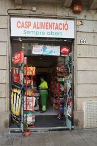
If you live on Carrer de Girona in Barcelona, as my family and I have for the past few days, and you have a sudden craving for a green pepper, a bottled water, a Filipinos chocolate treat or a Red Bull at 11:00 at night, you just roll out of the front door of your apartment building, stroll around the corner and walk into the Casp Alimentacio, which is “sempre obert,” always open. The hole-in-the-wall shop, which is a bit like a 7 Eleven without the Slurpee machines, stocks essential staples demanded by its clientele, the vast majority of whom live within a few minutes’ walk.

Casp Alimentacio would never survive in an American suburb, in which the number of households living within a short stroll could be counted on two hands. But the economics are very different in Barcelona, where buildings are packed wall to wall along every street, reach five stories high and jam dozen households in less space than it would take to hold a single American dwelling.
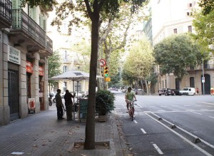
Sidewalk scene in front of 27 Girano. Note the two-lane bicycle lane and the restaurant tables on the sidewalk.

There are inconveniences associated with a dense urban setting, such as living in tight living quarters and the difficulty of finding parking spaces for your car. But there are compensating advantages, such as the proximity of groceries, restaurants and pharmacies within easy walking distance, as well as the existence of so many transportation alternatives that you can get along quite comfortably without an automobile.
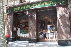
One of two pharmacies on the block.

Rather than discuss the wonders of Barcelona’s mid-rise density and mixed-use development in the abstract, I thought it would be useful to show those land use features in a real-life microcosm, here at the Carrer de Girona apartment where we are staying. I have navigated the block, taking photos of shops like Casp Alimentacio, neighborhood restaurants and other business establishments, as well as the streets themselves, to show the vibrancy of the Barcelona way of life.
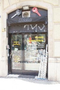
The neighborhood hardware store.

As luck would have it, my first outing occurred Tuesday, which, unknown to me, was a public holiday, the Assumption of Mary. Almost everything was shut down. Wow, this place is dead, I thought. And given the proclivity of vandals for spray painting graffiti on virtually every pull-down, corrugated metal door on every store in the city, the neighborhood looked like it was falling part. After learning of the holiday, however, I took another spin around the block. The place was much busier this morning, although there still were many empty storefronts. After all, it’s August, which means half the country is on vacation, many shopkeepers have closed their stores and many patrons have departed. Too, Barcelona’s economy, hobbled by Spain’s euro-crisis, is in unhappy condition and many businesses have closed in recent years. Moreover, the neighborhood is, shall we say, “in transition.” Long-term economic trends have pushed out many of the old commercial tenants, and Barcelona’s economy has not yet reinvented itself sufficiently to replace them all.

Still, all things considered, the commercial life of the block of 27 Girona is remarkably vibrant. An amazing number of people ply their trade and carry out routine daily activities in the very same part of town where they live.
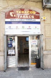
The absolute essentials: cigs and lottery tickets.

The contrast with Virginia, where people must hop in their cars and drive from cul de sac neighborhoods to “shopping centers” or “office parks” could not be more marked. I’m not saying that Barcelona is better, but I am saying that it is very different — and that it seems to work. And because it works, it challenges many notions about transportation and land use that Virginians take for granted.

By way of background, Girona is situated in a district of Barcelona, the Eixample, that was laid out in the mid-1800s by sublimely rational urban planners. The street system was a rigid grid, with each block 100 meters in length. The corners were cut off, creating sort of an octagonal shape, to allow horse-drawn carriages to turn corners more easily. The configuration adapted nicely to the mechanized age by creating places to park cars, motorbikes — and big, squat garbage/recycling bins. The streets are 10 meters wide, which allows room for two car lanes and a bicycle lane, while the sidewalks are 5 meters wide, allowing plenty of space for motor scooters, restaurant tables and other street life.
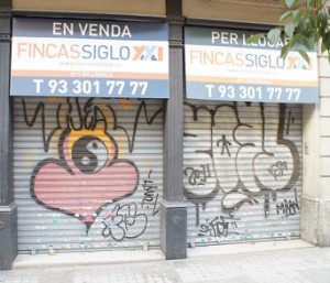
The streets of Barcelona's Eixample district have a good number of empty storefronts -- all of them marked by graffiti.

The streets are lined with tall trees, which create plenty of shade. In this part of town, the buildings on the back streets are uniformly five floors high, with the ground-level reserved for small shops and businesses, and the upper floors usually set aside for apartments and condominiums. Each apartment building is the same height and width, the windows reach from floor to ceiling and balconies are placed under every window, seemingly a formula for monotonous conformity. But builders and architects have created delightful variety in the stonework of the building facades and ornamentation, the shape and color of the windows, the use of cupolas and the jutting of windows over the sidewalk. The architecture is a pleasure to the eye. Isabel and Mike, the owners of our apartment who lived next door to our apartment until about two weeks ago, describe the neighborhood this way:

Most people in the immediate area are wealthy and well-educated by Catalan standards and you would describe them as middle-class. Many of our neighbours have inherited their apartments and typically they have second homes in the countryside or in the coastal villages where they tend to head for weekends and holidays. Children tend to go to private schools.  There has also been an influx of wealthy European residents in the last 10 years which has helped to support the local economy.  It’s a particularly safe area to live in. The crime rate (if you discount tourists being pickpocketed!) is low and violent crime is very rare.  You also won’t see public alcohol-related problems.

(Let me take this opportunity to put in a plug for our apartment. Check out Isabel and Mike’s home page at Sweet Home Barcelona.)
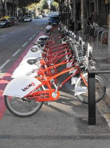
A "Bicing" station on the block provides a useful transportation option for a city with a Mediterranean climate.

There are, in our block alone, two active corner restaurants and two grocery establishments, two pharmacies, several clothing stores, a pilates center, a hardware store, a travel agency, a parking garage and a couple of businesses of indeterminate nature. There is a bank across the street as well as some kind of professional school (I can’t tell you what kind because I can’t read Catalan). In sum, there is a lot going on. If you were a free-lance IT consultant like Isabel and Mike are, you could have met your routine needs for days at a time without ever needing to walk more than a block or two. Should you need to go travel a greater distance, the city maintains a “Bicing” shared bicycle service on the far side of the block, and there are three METRO stations within a couple of blocks.

How does one explain all the empty commercial spaces? To anticipate the in-your-face reaction of Bacon’s Rebellion readers, if mid-rise, mixed use development is such a super-duper idea, why can’t it support more local business? I posed that question to Isabel and Mike. They responded:

Some store fronts in the area are vacant, but this has been the situation for a long time – not just in recent years – part of the reason is because many of the premises are very large because they housed large textile suppliers (the wealth of Barcelona was built on textiles in the 19th and early 20th centuries).  Many of the textile factory owners lived in the area known as the Quadrat d’Or which includes the apartment that you are renting. The store owners try to rent out the whole premises (frequently there are conditions on the deeds of the buildings that prevent shops from being sub-divided) but obviously this somewhat limits their market.  One recent change to this was the set-up of a car park last year in Carrer de Casp opposite the pizza restaurant.  This was previously a textiles warehouse – the textile company had moved to a location out of town and the warehouse had been empty for several years until the owners decided to convert it because they couldn’t find anyone to let it.
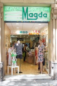
Spaniards are very fashion conscious.... but six clothing stores... all for women... in a single block? Really?

Clearly, Carrer de Girona’s land use does not insulate the neighborhood from short-term economic fluctuations such as the current euro crisis nor from long-term secular changes such as the restructuring of the textile industry.  The real question is this: How adaptable is the system? I would submit that, once you separate out the difficulties tied to the euro zone crisis and the transfer of wealth from affluent Barcelona to poorer parts of Spain, Barcelona’s system of medium-density land use is very adaptable. Developers are gutting several older buildings, taking care to preserve the magnificent historical facades, and are rebuilding them to meet current market demands. Also, as Barcelona shifts to an increasingly knowledge-driven economy populated with small business start-ups, the ubiquity of abundant, inexpensive office space should prove to be a tremendous asset to entrepreneurialism.
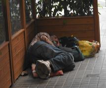
Sign of hard times: homeless man around the corner from our apartment.

What lessons does Barcelona hold for Virginia? Barcelona’s land use patterns would be impossible to replicate wholesale in the Old Dominion, even if people deemed them desirable. But there may be occasions to phase in compact, medium-density development at suitable locations. For instance, the Manchester district across the James River from downtown Richmond, where many of the old buildings have been leveled, could be organized around grid streets, mixed uses and multi-story buildings. Likewise, it might be possible to recycle old malls, with their giant parking lots, into mini-Eixamples.

But building three or four blocks would not generate all the benefits of comparable development in Barcelona. What makes the transportation system work in the Catalonian capital is the existence of hundreds of blocks like 27 Girona with sufficient population to sustain bus lines, the bicycle-sharing program and a Metro system. Still, the development pattern is worth experimenting with. Anything that economizes on the cost of maintaining infrastructure and that reduces the length and number of automobile trips has important advantages over scattered, low-density sprawl.


Now, That’s a Street!


by James A. Bacon

The city planners of Barcelona, as I pointed out in my previous post, pay great attention to the details of street design. In contrast to the United States, where planners and traffic engineers design streets to optimize the movement of automobiles, Barcelonians endeavor to strike a balance between all users of streets, including vehicles, pedestrians, bicycles and motorcycles. The result is an arrangement, which combined with a development density as much as ten times greater than Richmond and other Virginia cities, that makes it easier for people to reach more destinations by foot, bike or mass transit.

In our perambulations today, my wife, son and myself spent time walking along (and lunching on) the Avinguda Diagonal. It would be impossible to build such a boulevard in a Virginia city — acquiring the right of way would be prohibitive. I don’t present this beautiful street to Bacon’s Rebellion readers with the idea that Virginians should emulate it but simply to demonstrate that the way we do streets is not the only way to do them. Avinguda Diagonal, the grand boulevard of a great European city, reflects a state of mind that balances the needs of all modes of transportation, not just automobiles.

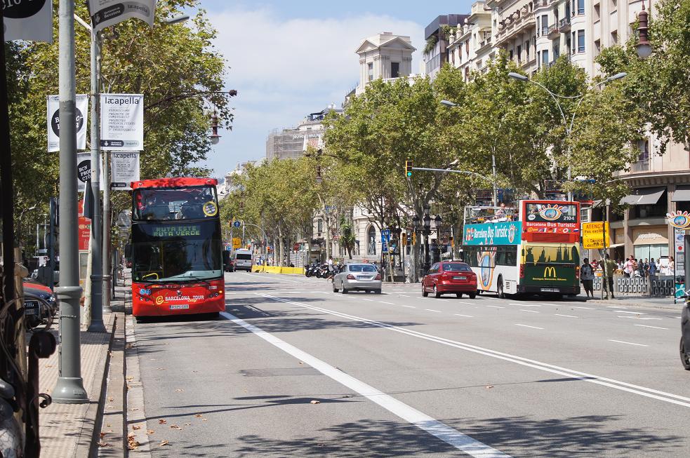
The series of photos here show views of the Avinguda Diagonal looking west, all from roughly the same point of the road. The first (above) shows the view of the main avenue, which is restricted to motor vehicles, including buses, which enjoy their own dedicated lane.

The second photo (immediately below) shows an adjacent utility road, which is separated from the main street by a  curb, sidewalk parked cars. We saw a number of bicycles and the occasional car using this path. In turn, this utility road is separated from pedestrians to the left by a row of trees and shrubbery.

And the third (below) shows a broad promenade alongside the phalanx of buildings. Here, people can walk, mingle and sit on benches with no fear of encountering cars. You can see how busy the walkway is. Undoubtedly, many of the people you see here are tourists who are drawn by two of Antonio Gaudi-designed architectural masterpieces nearby. But the ground level of nearly all buildings is dedicated to shops and offices which, I assume, draw a broad spectrum of the local population. To be sure, the street was not originally designed with the idea of attracting a tourist industry in mind.


Frankly, the Avinguda Diagonal, as beautiful as it is, strikes me as a bit of overkill. It must have been very expensive to build. You’d never see dedicated bike lanes and bus lanes on a single street in a Virginia city. On the other hand, the boulevard surely enhances the value of the magnificent buildings, which range from six to 10 stories in height, along the boulevard. Assuming Barcelona relies upon real estate taxes to finance its operations, the trade-off between taxes collected and expenditures spent maintaining the public areas of the street undoubtedly is a very favorable one.

World-Class Walkability in Barcelona

La Rambla, a Barcelona boulevard so beautiful that it attracts tourists and sight-seers by the thousands.

by James A. Bacon

I have spent barely one day in the city of Barcelona and I can tell you three things that I dislike: the ubiquitous graffiti, the giant, ungainly recycling bins at many street corners, and the faint but unmistakable odor of sewage emanating from the city’s subterranean labyrinth. But if I tried to tell you everything I love about this place, I wouldn’t have the time or space.

Barcelona is extraordinary. My wife, son and I have the privilege of spending five days here not only to delve into the history and culture of one of Europe’s great cities but to get a sense of how the people here live. Rather than staying in a hotel, we are renting a small apartment on Carrer de Girona (Girona Street) in the center of the city.  So far, it has been an awesome experience.

The city of Barcelona proper has a population of 1.6 million but it is part of a metro region of 4.5 million, the sixth largest in Europe. With its thriving port, extensive manufacturing and growing service sector, Barcelona is the economic engine of Spain. According to Wikipedia, it has the fourth highest per capita income of any region in the European Union, making it, much like Milan, Italy, a highly prosperous urban region in a much poorer country. Indeed, in the estimation of our taxi driver, a heavily tattooed young man who could have passed for a VCU student, Barcelona is keeping subsidizing the rest of rest of the nation through  taxes paid to the central government. However, even Barcelona has fallen on hard times since the collapse of the Spanish real estate bubble and the euro crisis. While unemployment in Barcelona is lower than the 25% average for Spain as a whole, it’s still running in the 18% to 20% range.

As part of the Catalan region of Spain, Barcelona has a distinct language and culture. The Catalan language, which traces its origins to Latin, is widely spoken. And Catalans, as our tax driver assured us, are more creative and industrious — no siestas here — traits to which they owe their prosperity. After fighting for centuries to retain their cultural identity from Castillian Spain, Catalans would be perfectly happy to divest themselves of their economically lagging cousins.

It goes without saying that the Bacon family will visit must-see spots such as the old Gothic city, the Gaudi-designed cathedral and the Picasso Museum, but what fascinates me most is the everyday urban fabric off the well-beaten tourist track. I want to see how human settlement patterns affect the way Barcelonians live.

Barcelona is a mid-rise city. There are a few skyscrapers but not as many as I would have expected for such an important city. The standard on most streets is five to ten stories. The pattern creates a very human scale of development. No one feels dwarfed by the built environment yet mid-rise buildings yield a remarkably high level of density when applied uniformly, as has been the case for much of the 19th and 20th centuries. The city proper contains 40,000 people per square mile on average. By way of comparison, population density is 3,000 per square mile in the City of Richmond, 8,000 in Arlington, 17,000 in San Francisco and 67,000 in Manhattan.

Another remarkable thing about Barcelona is the very different allocation of public space versus private space. This was immediately discernible from the air as our Lufthansa airplane circled over the Mediterranean Sea and approached the airport. The city consists of solid, wall-to-wall buildings, except where it is spliced with strips of green. The streets, you see, are all lined with healthy, beautiful trees. In the urban core, I espied little resembling the private back yards so common in urban American. Barcelona’s energy is focused on the street.

A plaza in Barcelona's Gothic district. Barcelonians are masters at creating walkable communities.

Outside of the Gothic district dating back to the Middle Ages, the street system is a rigid grid with occasional diagonal avenues. The grid allows the use of one-way streets, which in turn enables the city to provide two lanes of vehicular traffic, a lane for bicycles, plus broad sidewalks. The sidewalks represent a transition zone between streets and the interior space of the buildings. Thousands of motor bikes are parked on the sidewalks, leaving ample room for people to walk. And almost every restaurant in the city spills into the adjoining sidewalk with tables and umbrellas. Thanks to the phenomenal Mediterranean climate — the current daytime  temperature is in the low 80s with low humidity — people are more inclined this time of year to drink, dine and socialize outside than in.

“Mixed-use development” is the development buzzword in the United States. Barcelona has no need for it. Barcelona is one big mixed use development. Retail and residential are mixed like salt and sea water — on every block, the ground-level floor consists of shops and small businesses, while the four stories above are comprised of apartments and condominiums. Many daily destinations are found within easy walking distance: drug stores, grocery stores, restaurants, shops.

The combination of high density and grid streets makes it possible to easily reach a wide range of destinations on foot. For longer trips, the city provides an incredible network of bus lines, a subway system and ubiquitous shared bike stands where, for a couple of euros, you can rent a bicycle, ride it to any corner of the city and drop it off at another stand no more than a couple of blocks from your destination. There are cars on the streets, to be sure, but traffic is always free flowing.  It is beyond the reckoning of Americans how little congestion is generated by so much density. (Catalonians say that traffic is better in August when everyone is on vacation.)

Admittedly, I know nothing of the finances of operating this transportation system. For all I know, the buses, trains and bikes represent a debilitating drain on the city treasury, an unaffordable luxury that will come crashing down when the rest of Europe can no longer afford to bail out Spain and its spendthrift regional governments. Indeed, this May Catalonia President Artur Mas warned that the regional government was running out of options for paying its bills, sending Spanish bond buyers into a tizzy. On the other hand, I would say this: It would be very easy to live in Barcelona without incurring the considerable expense of owning and operating an automobile. Your paycheck goes a lot further if you don’t need a car.

Not everyone in the U.S. would want to live like the Barcelonians do. The apartments are small. Many Virginians could not abide living in such modest quarters (no matter how gorgeous the architecture, which puts ours to shame) with so little space to put all their stuff. Some could not live without an automobile in their private garage. I don’t know if I would want to live like the Barcelonians. But to all appearances, Barcelona represents an urban model conducive to economic prosperity in the post-industrial knowledge economy, and it stretches the mind of a Virginian like me to see how differently a globally competitive region has organized itself.

Update: Many thanks to the two Catalonian bloggers who left lengthy messages critiquing my post. I have changed my unfortunate characterization of the Catalan language as a “mash up” of French and Italian to reflect its evolution as an independent tongue that can be traced back to Latin. As for the intricacy of Catalan politics and finances, I refer readers to the two commenters themselves.

Gulp. Wal-Marts Increase Nearby Property Values

by James A. Bacon

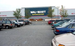
Intellectuals love to hate Wal-Mart. A vast cottage industry exists for the sole purpose of criticizing and thwarting the the opening of new stores. I suppose you could call me a fellow traveler. While I respect the retail giant for pioneering a logistical revolution that has squeezed tremendous costs out the distribution system to the benefit of us all, I find its big box stores an abomination. Wal-Mart’s massive, hulking buildings surrounded by acres of parking lot are desolate and soulless. You go to Wal-Mart for one reason, to shop, and you usually get there by bypassing neighborhood stores and driving long distances. Wal-Marts and other big boxes are pillars of the auto-centric society and the antithesis of the vibrant and walkable communities where I enjoy hanging out.

My attitude, I concede, is snobbish. Not everyone shares my predilections. Wal-Mart appeals to lower-income (but not so low-income they can’t afford a car to reach a superstore) consumers who need to stretch a dollar. And, it turns out, many people who live near Wal-Marts don’t share my aesthetic sense.

A recent analysis published by the National Bureau of Economic Research concluded that Wal-Marts actually raise property values of surrounding houses, though only modestly. Write Devin G. Pope and Jaren C. Pope:

The results … suggest that a new Walmart store actually increases housing prices by between 2 and 3 percent for houses located within a half mile of the store and by 1 to 2 percent for houses located between a half and one mile from the store. For the average priced home in these areas this translates into an approximate $7,000 increase in housing price for homes within a half mile of a newly opened Walmart and a $4,000 increase for homes between a half and one mile.

The authors acknowledge that the Wal-Mart effect might combine both positive and negative influences. If households value the convenient access to Wal-Mart’s goods and services, as well as those of other merchants that might choose to locate nearby, the impact would be positive. If Walmart brings pollution, crime and traffic to a neighborhood, the impact could be negative. There is no way to know a priori which effect is the stronger.

Pope and Pope compiled a data set of 159 Wal-Marts that opened in the United States between 2000 and 2006 and then analyzed the impact on housing sales prices within one and a half miles from the stores. Their results show that Wal-Mart lovers prevail over Wal-Mart haters.

That’s fine as far as it goes. But I wonder if it might be possible to refine the analysis. Not all Wal-Mart stores are the same. The stereotyped big box is a 140,000-square-foot behemoth in a free-standing building. But having largely saturated the market for those monstrosities, the retailer has been building considerably smaller stores, in the range of 40,000 square feet, in recent years. There is one three miles from where I live in Henrico County, and it’s not so bad. Wal-Mart plugged it into an an existing shopping center, so it did not diminish the surroundings. Visually, it’s a marginal improvement over the failing K-Mart that had stood there. While I never patronize the behemoth Wal-Mart 20 minutes away, I find this one convenient and relatively inoffensive. Meanwhile, the company is experimenting with even smaller stores, around 16,000 square feet in size, in urban areas under the “Marketside” brand.

Just as McDonald’s has learned to succeed in urban environments by foresaking its tacky golden arches, is it too much to hope that Wal-Mart might one day learn to do the same? Is there any way to integrate Wal-Mart’s hyper-efficient, low-cost supply chain into a compact, walkable, fiscally sustainable setting? If Wal-Mart wants to continue growing market share, it may have no choice but to adapt.