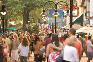
If you haven’t checked your home’s walk score, you should. Walkability contributes to higher property values, a more livable neighborhood and a healthier community.
by James A. Bacon
Walk Score, a web-based service that measures walkability, is taking the urban planning profession by storm. Using an algorithm that awards points based on the distance to amenities within a location’s walking distance, Walk Score purports to measure the walkability of a neighborhood, city, county or even an entire region. The algorithm is far from perfect but it gives a pretty good rough cut.
Walkability matters a great deal. This crucial amenity affects property values; houses with higher Walk Scores enjoy higher property values per square foot. “In the typical market, an additional one point increase in Walk Score was associated with between a $500 and $3,000 increase in home values,” writes Joe Cortright in “How Walkability Raises Home Values in U.S. Cities.” Walkability also affects public health — there is a strong correlation between a person’s weight and how much he or she walks.
Walk Score rates places on a 1-100 scale, with 90-100 rated a walker’s paradise, 70-89 as very walkable, 50-69 as somewhat walkable, 0-49 as car-dependent.
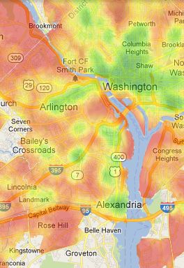 Not surprisingly, the most walkable parts of Virginia are close to the urban core of the Washington metropolitan region, with Arlington and Old Town Alexandria racking up very high scores. As seen in the map to the left, high-walkability areas are shown in green, shading off to yellow, orange and red for lower levels of walkability. Northern Virginia has smaller islands of walkability in Reston, McLean, the City of Fairfax and… get this… Tysons.
The Tysons example points out the limits to the Walk Score methodology. Although the business district has a relatively high level of density, which means destinations are relatively close to one another, the ubiquity of parking lots and the paucity of pedestrian-friendly streets makes it one of the more pedestrian-hostile places outside the Daytona Speedway. Additionally, there is a poor balance of residential and retail-commercial; the only reason people working in Tysons have for walking is to traverse the parking lots to get to their cars and drive home! (See the metro-wide heat map here.)
The Walk Score people freely concede that their system, based on Google Maps, does not take those factors into account. “Walk Score simply measures the straight-line distance to … locations and makes no adjustments for ease of walking or other obstacles to walking,” states the website. “In essence, Walk Score is a measure of the proximity of a range of typical goods, serviecs and activities to a particular household.”
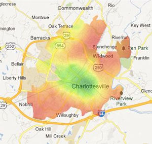 Among metropolitan areas, the highest score outside of the Washington area is Charlottesville, with a walk score of 63. There is high walkability around the University of Virginia, downtown and the area in between. Downtown, with its pedestrian mall, ranks especially high. (See the heat map here.)
Considerably lower down the scale comes another college town, Harrisonburg, which rates a “somewhat walkable” score of 53. (See map.)
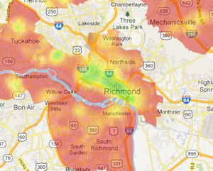 Right on its heels is Richmond, with a score of 51. (See map.) The city has a highly walkable core, extending from downtown to Shockoe Bottom in one direction and to the Fan and the Museum District in the other. Other than one small patch — the so-called Libbie & Grove area — the region is a lost cause otherwise. Walk Score bequeaths a walk score of 9 to my suburban Henrico neighborhood, meaning that “almost all” errands require a car. That’s “almost all,” as in 99.9%. Not only are stores and restaurants two or three miles distant, but there is no connectivity between subdivisions, with the result that the only way to reach those destinations is Parham Road, a four-lane, divided road with 45 mile-per-hour speed limit and no sidewalks.You would have to be insane to walk anywhere! Read more.

