
 Broadly speaking, there are two ways to go about buttressing Virginia’s waterfront communities from flooding, storm surges and other risks associated with rising water levels: with hard infrastructure and soft infrastructure. Hard infrastructure consists of walls, levees, berms, jetties, pipes, pumps, sand replenishment and other expensive, engineered solutions. Soft infrastructure entails building up of biological systems that absorb water and buffer against pounding waves. A combination of both probably will be needed to protect Virginia’s fragile coastline. As always, the question asked by Bacon’s Rebellion is this: Which measures are the most cost-effective?
A new article just published in Nature publishes national maps showing which sections of the U.S. coastline will have the greatest exposure to rising sea levels and degraded coastal ecosystems by the year 2100, based on models from the National Climate Assessment. (The National Climate Assessment takes as a starting point the notion that human-caused climate change will lead to disastrous sea-level rises, so if you find the whole Global Warming thing to be a trifle alarmist, you can discount some, but not all, of what I’m about to tell you.)
In one of the five sea level-rise scenarios explored by the authors, the Chesapeake Bay fares relatively well by comparison to other East and Gulf Coast shorelines. Indeed, other than Florida and Maine, the Bay and its southern neighbors, the Pamlico and Albemarle Sounds, appear to be among the least vulnerable spots on the East Coast. Such an assessment is entirely relative, of course: Significant stretches of the Bay are ranked “highest” in the article’s hazard index.
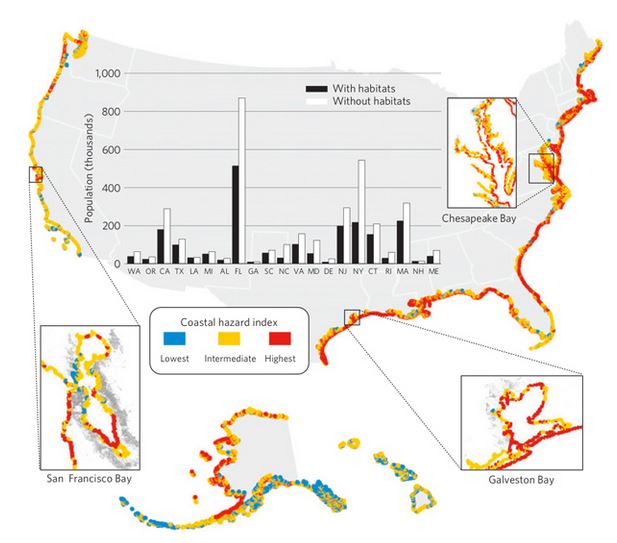
Graphic credit: Nature. (Click for larger image.)
The article factors in “the presence of protective offshore habitats; the type of shoreline (beach, cliff, etc.); and the spot’s exposure to wind, waves, and other weather,” summarizes Tim McDonnell for the Atlantic Cities blog. (The Nature article hides behind a pay wall; read the blog for a somewhat more detailed account than the magazine’s preview.) One thing Virginia’s coastline has is a lot of wetlands. But our natural, biological defenses probably could be strengthened.
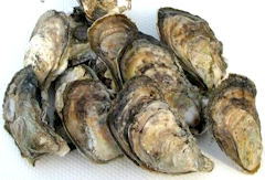
Oysters on the whole shell. Which brings us to an interesting, if underplayed story here in Virginia…. The Commonwealth is spending $2 million to mine fossilized oyster shells from beneath the James River as part of the greatest oyster replenishment initiative in state history. By the end of the month, the state will have deployed an estimated 1 million bushels (containing roughly 1 billion individual empty oyster shells) on state-owned public oyster grounds. It is hoped that naturally occurring oyster larvae will attach to the shells during spawning and grow to adulthood.
The Virginia Marine Resources Commission calculates that every $1 spent by the state yields $7 in direct economic benefits in the form of larger oyster harvests that create jobs for harvesters, shuckers, packers and shippers. Then there are hard-to-quantify environmental benefits. One adult oyster can filter 50 gallons of water per day. Oyster reefs also provide habitat for other species, notes a press release from the governor’s office.
Last but not least, oyster reefs along shorelines have value as breakwaters, dissipating the energy from pounding waves. If Virginians want to protect their communities from rising sea levels (whether due to geological subsidence or melting glaciers), restoring the Chesapeake’s once-prolific oyster reefs could well provide more economic bang for the buck than any other alternative.
— JAB

