
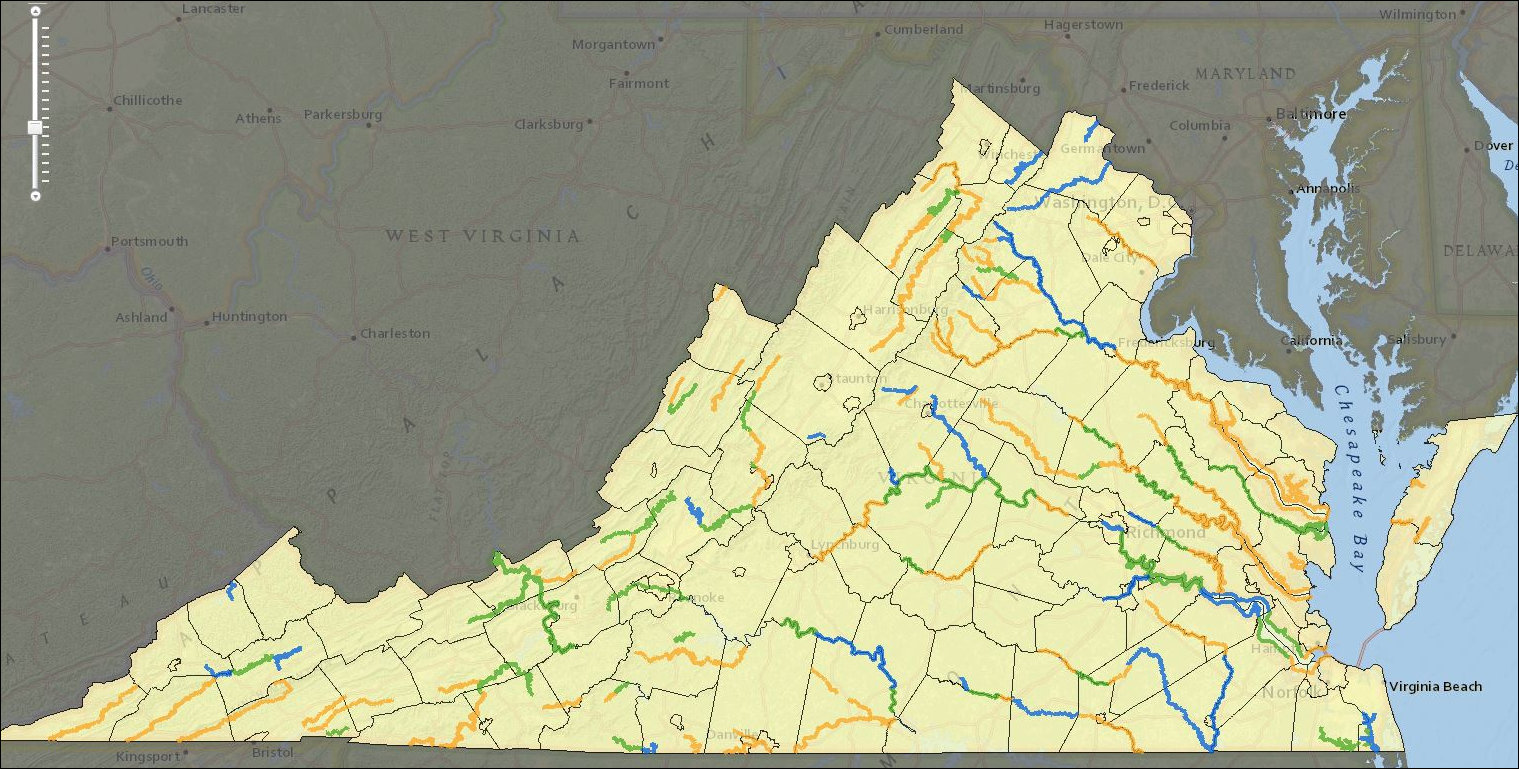
Virginia scenic rivers. Source: ConserveVirginia. Click for larger image.
The Northam administration has launched ConserveVirginia, a “smart map” that identifies 6.3 million acres of high priority conservation areas. The map draws upon 19 data sets in six broad categories: agriculture & forestry; natural habit and ecosystem diversity; floodplains and flooding resilience; cultural & historic preservation; scenic preservation; and landscape resilience.
“It is time to take a more scientific, data-driven, and accountable approach to land conservation in our Commonwealth — ConserveVirginia is about using the best information we have available to identify our true conservation needs and focus on protecting our limited resources,” said Northam in a press release earlier this week. “When Virginians invest their tax dollars in conservation projects, we have an obligation to ensure those efforts yield the greatest benefits in the most cost-effective manner for the Commonwealth.”
The map provides a concrete tool for pursuing a land-conservation strategy Northam announced a year ago. Working with state agencies and partners, he said, the administration would prioritize protection of the top 2% of lands with the highest conservation value, with the goal of protecting the top 10% within ten years.
Bacon’s bottom line: I have long called for prioritizing the issuance of $75 million a year in conservation-easement tax credits by preservation value, and I am delighted that the Northam administration views the expenditure of scarce state fiscal resources the same way. The ConserveVirginia maps looks like a useful tool in helping set those priorities.
It’s not clear from the governor’s press release, however, which initiatives will be informed by the data. Will the maps be used to prioritize the granting conservation easements? Will the data guide the acquisition of lands for state parks? Will it inform the designation of scenic rivers and highways? Will it be integrated into land use planning? Or is Northam just articulating a vague aspiration? The press release is lamentably vague.
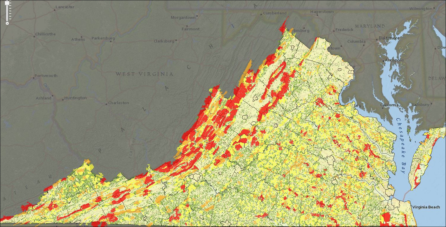
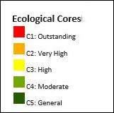
Furthermore — and I concede that this is a quibble — the maps are of limited utility to the general public at present. They provide no color coding! The map above of scenic rivers, for instance, does not define the difference between rivers coded blue, yellow and green. The map below of “ecological cores” does not define the difference between red, orange, yellow, dark green and pale green.
The mapping labels are easily resolved. The use to which the data will be put is quite another matter. I look forward to seeing concrete proposals. Whatever happens, assembling hard data and making it accessible to lawmakers, regulators, and the public does represent a step forward.
 Update: Charles Winkler provides the following table for this map:
Update: Carol Bova explains how a subscription is needed to access the full capabilities of the ConserveVirginia maps.

