
by Dick Hall-Sizemore
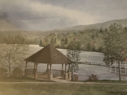
Mountain Lake in Giles County has two claims to fame. First, it was the location at which much of the 1987 hit movie Dirty Dancing was filmed. Second, it is one of only two natural lakes in Virginia. (Lake Drummond in the Dismal Swamp in Chesapeake is the other one.) However, the basis of that second claim may be fading away.
Mountain Lake is situated in a bowl, or valley, between two converging mountain ridges. A stream, Pond Drain, flows through the valley. At one end of the valley is a narrow water gap. Salt Pond Mountain rises to the east immediately adjacent to the lake. The Eastern Continental Divide runs along the crest of Salt Pond Mountain. Surface water on the western side of the mountain flows to the New River and, ultimately, to the Gulf of Mexico, while surface water on the eastern side flows to the Atlantic Ocean via the James River and its tributaries.

There has been considerable debate among geologists regarding the origin of Mountain Lake. The first scientific work on the lake was conducted by William Rogers. Rogers taught chemistry and natural philosophy at the College of William and Mary and was later chair of natural philosophy at the University of Virginia. While at UVa., he became the first state geologist and led the first geological survey of the state. He later founded the Massachusetts Institute of Technology. (Rogers Hall at William and Mary is named for him, as is Mt. Rogers, the tallest mountain in Virginia.) Rogers’s work was published posthumously in 1884. His conclusion for the origin of the lake: “Rocks and earth gradually accumulating at the passage have dammed the waters up.”
Over the years, other explanations have been offered. They include: a volcanic crater and lava flow; glacial action; meteoric crater, and subsidence. Beginning in 2010, researchers from Radford University, Virginia Tech, and Kent State University began extensive collaborative studies of the hydrology and geology of Mountain Lake. Using the most recent scientific equipment, they concluded that William Rogers was right—the mass movement of rock into the stream bed had dammed the stream, thereby creating the lake. Among their findings in the dam were sandstone slabs, boulders of various sizes, and massive rock blocks, tens of feet in size. Data from the site suggest the larger blocks and boulders were deposited there 4,000-6,000 years ago, “relatively recently” in geological terms. Giles County is in one of the state’s seismic zones and an earthquake would be one logical explanation for the displacement of the rock.
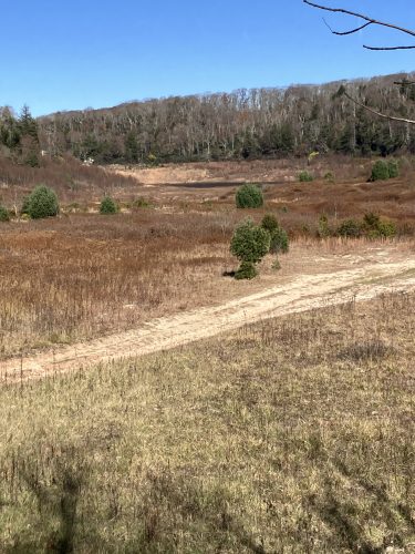
Mountain Lake has all but disappeared. From 1998-2002, it shrank by half, down to 25 acres. It recovered to its full level in 2003, but the water level began to recede until the lake was almost completely drained by 2008. The skeleton of a fisherman who had fallen out of his boat in 1921 was exposed. There was some recovery until it was one-third full in 2020. However, the water level receded again until what was once a 50-acre lake is now only a small water body (pond?) that can barely be seen from the hotel at one end of the lakebed.
Although it came as a surprise, the draining of Mountain Lake is not unprecedented. Indeed, it may be part of a natural cycle.
First, there is anecdotal evidence. Christopher Gist, a British surveyor believed to the be first European to see the lake (or, at least, to record it), after happening upon it in 1751, wrote in his journal of traveling “to a very high Mountain up on top of which was a Lake or Pond about ¾ of a mile long NE & SD, & ¼ of a mile wide….” However, only 27 years later, in 1768, settlers recorded just “a spring in a valley with a grassy meadow.” As has already been discussed, William Rogers described a lake in the mid-1800s.
Then there is the scientific evidence. Analyses of the sediments in the lake bed indicate that the lake has been at very low levels or dried up at least six times in the past—100, 400, 900, 1,200, and 4,200 years ago.
The explanations offered for the tendency of the lake to drain and refill boil down to: Natural lakes, unlike manmade lakes, are not watertight. They leak.
Mountain Lake has two sources of leaks. An obvious source is the dam. As Skip Watts, emeritus professor of geology at Radford University, describes it:
“One of the characteristics of a natural landslide dam is that landslides don’t make really, really good dams, compared to a manmade dam. They’re basically just huge blocks of rock. And then the blocks don’t fit together perfectly like a 3D puzzle. So you have openings between the blocks. And those openings when the landslide originally happened were all filled with smaller, finer debris. And so it starts off making a pretty good dam. And then as the thousands of years roll by, sometimes some of that fine material between the large landslide blocks is eroded out in a process called piping. The definition of piping is internal erosion. And so as the water works its way into the dam it can create a conduit that goes through the dam and takes out some of the sediment.
“It can go through cycles where sometimes the conduits are open, and the dam doesn’t hold water. Sometimes they’re closed and the dam does hold water. Sometimes these conduits can shift around. One will fill up with sediment and block the flow of water, but another one nearby might open up, so it’s kind of like a game of Whack-a-Mole.”
The other source of leaks is the lakebed itself. Under the lake is sandstone and mudstone. When the lake began to drain earlier in this century, geologists discovered four major depressions, which denoted cracks in the underlying rock. These cracks constituted “piping holes,” though which water flowed into underground streams. One theory was that, when these piping holes became clogged with sediment, the lake was able to fill up. Occasionally, an earthquake would displace the sediment plug enough so that water could again flow through the holes, thereby drawing down the water level of the lake. In 2013, the owners of Mountain Lake contracted to plug the holes. The water levels began to rise, but it was only temporary, as more holes developed.
Geologists studying Mountain Lake talk in terms of cycles. However, those cycles are dependent on earthquakes, which are not predictable. As Watts, the Radford geologist, explains:
“Through the history, the sedimentological evidence indicates that it has sometimes been full of water, and sometimes it’s been empty completely. So it goes through long-term cycles. It may not fill back up naturally within our lifetimes, or it might. It kind of depends on whether or not those conduits get plugged back up again.
“And that could happen, if there was an earthquake in the Giles County seismic zone that shakes everything up. The material that’s all loose, that makes up this landslide dam could readjust itself, and close some of those conduits, in which case, an earthquake could cause the lake to come back. Could also be that an earthquake shaking up the dam could open up conduits, even more so than they are now.”
The management of the hotel at Mountain Lake before 2000 may not have understood the reasons behind it, but they seemed to realize that they had a leaky dam and that a full lake was important for their business. One of the recent geological studies noted, “…hotel management earlier in the twentieth century (may have) artificially modified hydraulic conductivity enough to ‘tip’ the water balance in favor of a full lake.” That careful scientific language alludes to reports that the management of the hotel directed staff to dispose of old mattresses in the lake next to the dam.
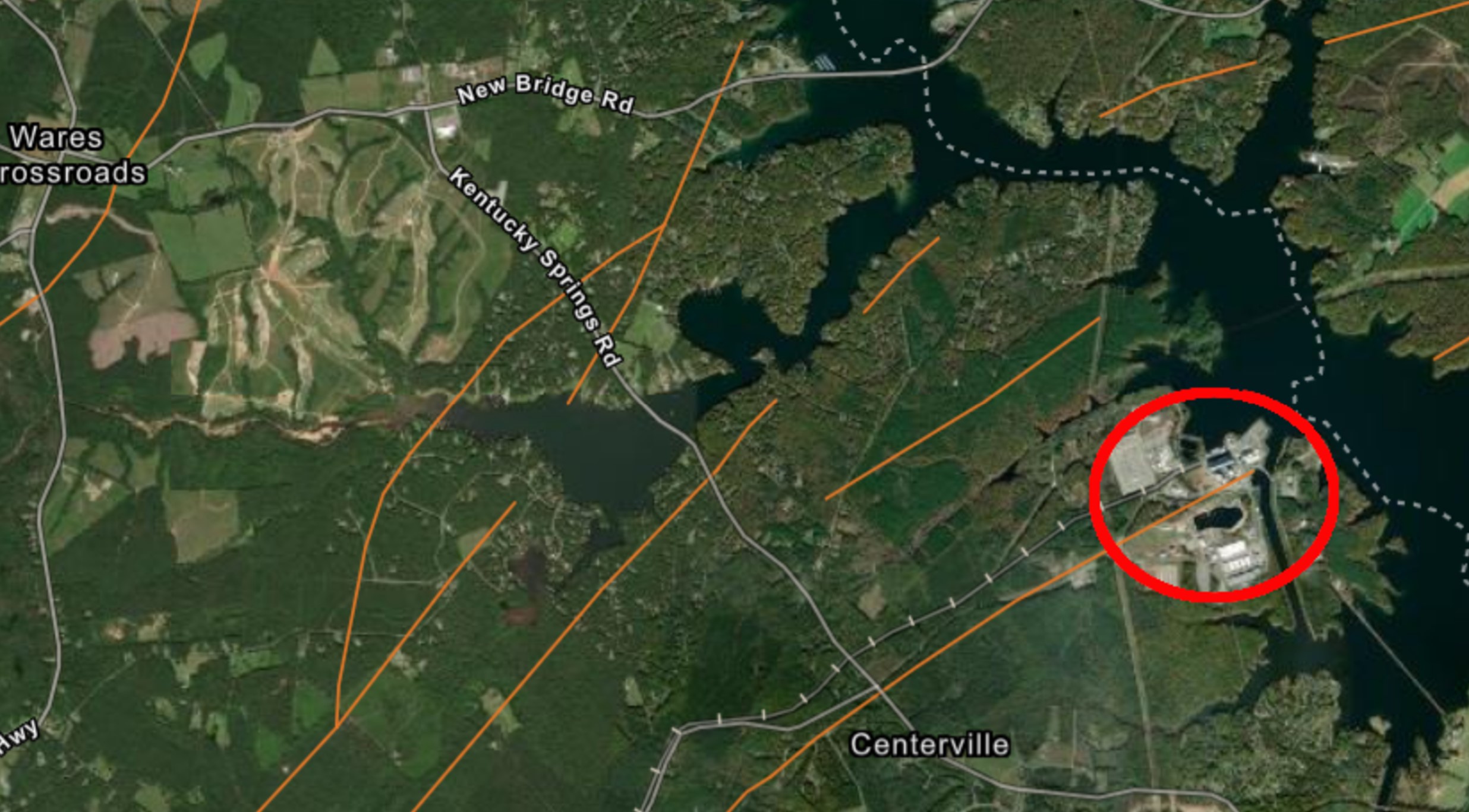
Most of the attention has centered on the outflow portion of the equation governing water level. There has been a development affecting the other portion of the equation, inflow, that might have even more of an impact on the chances of the lake recovering to its former size and depth. In the early 2000’s, a conference center and vacation cabins were built on a ridge above Mountain Lake. In accordance with state mandated stormwater regulations, water retention basins were constructed for the project. Those basins did their job and retained water and diverted it. Unfortunately, the water was diverted from Mountain Lake to a nearby alternate creek drainage area. Geologists and hydrologists estimate that 30 percent of the runoff expected to enter the lake has been lost.
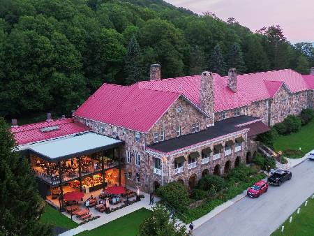
There has been a resort on the lake shore since the 1850s. In 1936, William Lewis Moody of Galveston, Texas, built the large sandstone lodge that is still in operation. The property remained in the Moody family until 1986 when trustees of the estate of the last owner established an endowment that owns and operates the resort.
After the attempts to plug the piping holes did not succeed in bringing back the water level, the board of the endowment decided to pivot from its focus on the lake. It spent $2.5 million to renovate the lodge, upgrade the rooms, and develop outdoor activities. It began to promote the Mountain Lake Lodge, with its 22 miles of hiking trails and spectacular mountain scenery as “about getting outdoors and a great place to just ‘get away’”.
In addition to the mountains, the Lodge capitalizes on its association with Dirty Dancing. Its website lists numerous Dirty Dancing “weekends”, in addition to numerous holiday-themed events. One can stay in “Baby’s Cabin” or in the room used by Patrick Swayze during filming. The approach has borne dividends. On a recent Saturday, the parking lot was full.
As for the lake, it may be in one of its periodic cycles and refill again sometime in the future. Then, again, it might not. In the meantime, designating it as a lake seems a stretch.
Note on sources:
I relied on the following as source material for this article:
- Guidebook for the 2024 Virginia Geological Field Conference, held at Radford University, Nov. 1-3, 2024
- An article in Cardinal News: https://cardinalnews.org/2022/12/05/geologists-still-plumbing-the-secrets-of-mountain-lake-and-its-mysterious-fluctuations/
- A entry in the blog, Virginia Places: http://www.virginiaplaces.org/watersheds/mountainlake.html. For anyone interested, this entry goes into great deal, in layman’s language, about the “plumbing” of Mountain Lake and the explanations offered for the periodic draining and refilling of the lake.
Leave a Reply
You must be logged in to post a comment.