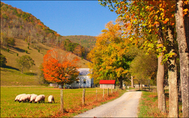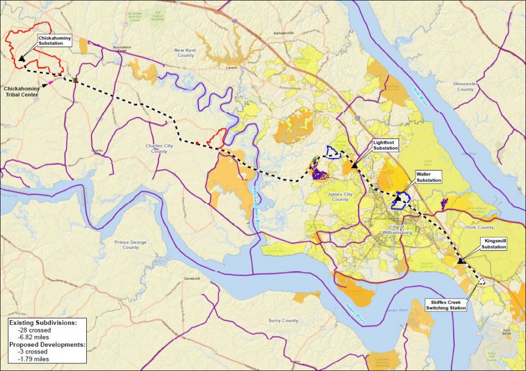
Map 1: Subdivisions and recreation areas. Proposed Chickahominy-Skiffes Creek transmission line route. (Click for image.)
Virginians need pipelines and transmission lines to keep the economy humming. But we also value our historical, cultural and historical heritage. The trade-offs are getting harder and harder.
by James A. Bacon
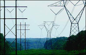
In the 1970s engineers at Dominion Virginia Power envisioned the need to increase the supply of electric power to the Virginia Peninsula one day. The logical course of action at the time seemed to be hooking into a 500 kV substation north of the James River in Charles City County, skirting Williamsburg, and plugging into a York County switching station where the power could be stepped down to lower voltages. To secure the route, the company proactively procured easements the entire length. It seemed an example of far-sighted planning.
When the Environmental Protection Agency enacted new toxic-emission standards earlier this decade that would compel Dominion to shut down its Yorktown coal-fired power plants, the company dusted off plans to import electricity from outside the Peninsula. However, taking a close look at the route, Courtney Fisher, an electric transmission siting and permitting specialist, found that many things had changed since the 1970s. Developers had built subdivisions right up to the easement. Environmental laws had became stricter, creating protections for wetlands and waterways. Government agencies had created classes of protected land, such as parks, conservation districts and agricultural/forestal districts. Private landowners had set up conservation easements. Society as a whole placed greater value upon scenic vistas and cultural resources like churches, battlefields, cemeteries and Indian settlements.
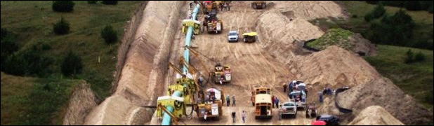
Even though Dominion owned the right of way, it didn’t take many public hearings to realize that building a high-voltage transmission line along that route would be a public relations disaster. The 38-mile line would cross 28 subdivisions and 300 parcels, leaving 1,129 residences within 500 feet of the line.
“The easement was purchased but the land was never cleared,” Fisher said. “Through the years, people bought houses. Their plats should have showed the easements. Some showed our transmission line easements and some did not. In either case, a line on a piece of paper is very different from the reality.”
Making matters worse, the transmission line would cut through 21 miles of forest land, requiring the clearing of 420 acres of trees, and it would affect 253 acres of wetland and forested wetlands. A crossing over the Chickahominy River would disrupt views to one of the most pristine stretches of river in eastern Virginia. To top it all off, the Chickahominy Indian tribe expressed concerns about the proximity of the line to its lands.
The route would have been so disruptive that Dominion decided to push an alternative, the 7.4-mile Surry-Skiffes Creek route across a historic stretch of the James River, arousing the wrath of conservationists and preservationists in the Williamsburg area and around the state. As controversial as that proposed route has proven to be, Dominion believes the Chickahominy route would have been worse.
When it comes to picking a route, sometimes there are only painful choices, says Fisher. “We know we can’t please everyone, but we strive to minimize overall impacts.”
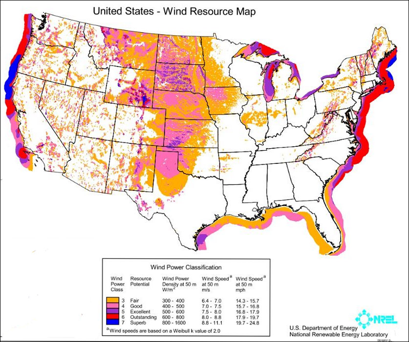
As the United States adapts to a post-coal era of more solar, wind and natural gas, major energy corporations are actively seeking to acquire right of way for two major gas pipelines and build several electric transmission lines in Virginia, with more projects waiting in the wings. The problem is that more places on the map are designated off-limits than ever before.
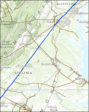
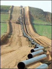
Route of the Williams Companies’ Transco pipeline, built circa 1950.
Building gas and electric lines was a lot easier a half century ago when projects disturbed little more than farm and woodlands. Witness the Transco pipeline built through Virginia around 1950 in a straight line. For purposes of acquiring right of way, it was a straightforward proposition to calculate the loss of economic value to a farm or a timber stand to compensate a landowner for an easement across his land.
Since then, suburban sprawl has smeared low-density subdivisions across vast swaths of the landscape, while changing societal values have placed a priority on preserving Virginia’s cultural, historical and environmental resources. Try assigning an economic value to a family cemetery, an expanse of marsh grass or the bucolic view from a vineyard.
Gas and electric companies follow a standard procedure when plotting routes for pipelines and transmission lines. The preliminary step is to plot the most economical path from Point A to Point B, using detailed maps identifying terrain features as well as environmental, historical and cultural assets in the path. Within the budget constraints of the project, they are willing to zig and zag to avoid sensitive locations. If it is impractical to steer around a subdivision, wetlands or scenic vista, utility companies endeavor to minimize the impact — whether drilling through mountains, in the case of pipelines, employing low-glare materials to build a transmission line, or utilizing any number of other strategies. Then begins the open houses and meetings with affected landowners, federal and state agencies and other interested parties to refine the proposed routes further.
A particularly thorny set of issues revolves around how much money utilities should spend in order to avoid or mitigate these conflicts. If a pipeline or transmission line diminishes viewsheds and destroys economic value, how much of that cost should be shifted to rate payers and how much should be absorbed by the property owner? And what happens if a historic, cultural or environmental asset is priceless? Bacon’s Rebellion will explore those issues in an upcoming article.
However those issues are decided, Virginia will be seeing more of these conflicts. To show how challenging it can be to plot a route, Bacon’s Rebellion sat down with Fisher to discuss the challenges posed by the Chickahominy-Skiffes Creek route and with Robert M. Bisha, director-environmental business for Dominion Resources, to walk through the major choke points in the proposed Atlantic Coast Pipeline. Continue reading →